
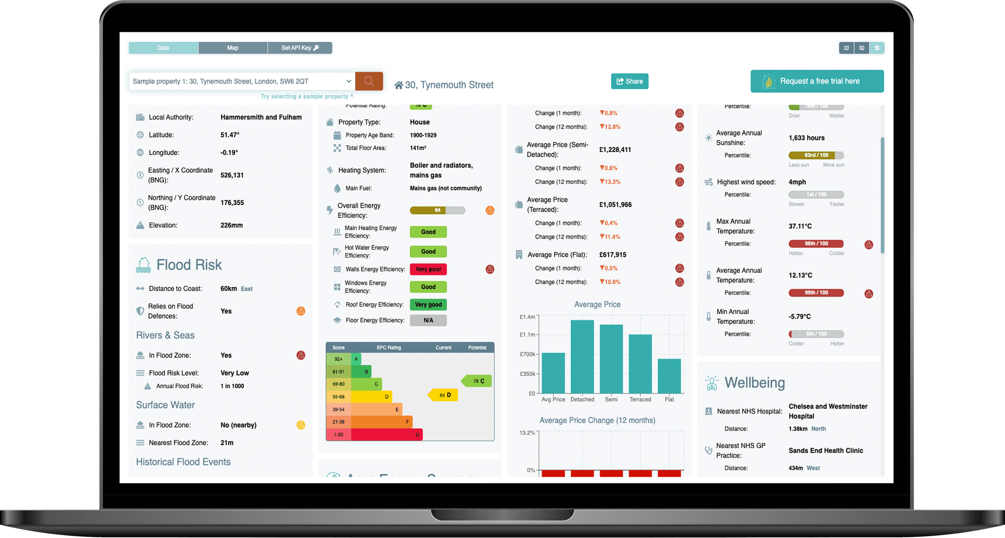
The PropEco Location Data API provides location-specific data & analysis relating to a wide range of social & environmental features including:
 Environmental risks
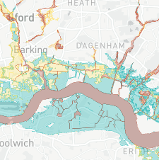
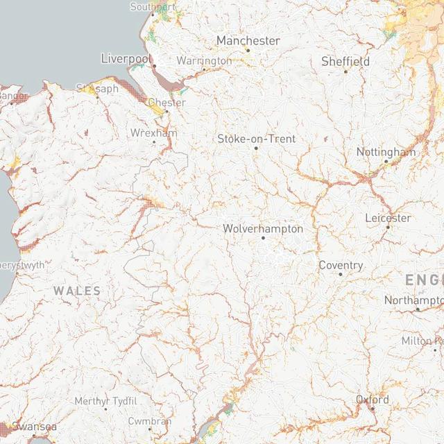
Including flooding (from rivers and seas), coastal erosion, radon exposure and landslides.
 Energy efficiency
Including retrofit grants, planning restrictions and related statistics.
 Climate
Historical trends and future projections covering rainfall, temperature, sunshine and wind.
 Area attributes
Including air quality, house price trends, fuel poverty rates and average energy consumption.
 Access to amenities
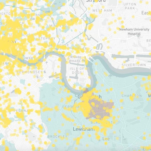
Including greenspace, hospitals, GP practices, EV chargepoints and defibrillators.
 Location details
Details of the administrative boundaries within which the property sits.
{
	"location": {
		"x_coord": 202301.00063404397,
		"y_coord": 47401.99935107064,
		"latitude": 50.29336962725581,
		"longitude": -4.7769688487838025,
		"admin_boundaries": {
			"electoral_area_code": "E05013846",
			"country_code": "E92000001",
			"electoral_area_name": "Mevagissey & St Austell Bay",
			"local_authority_district_code": "E06000052",
			"local_authority_district_name": "Cornwall",
			"county_code": null,
			"county_name": null,
			"region_code": "E12000009",
			"region_name": "South West",
			"country_name": "England"
		},
		"elevation": {
			"elevation_upper": 60,
			"elevation_lower": 50,
			"elevation_estimate": 55.87445401285399,
			"distance_from_upper": 61.95225853286166,
			"distance_from_lower": 43.50819514896648,
			"azimuth_ascending_degrees": 325.46917425770096,
			"azimuth_descending_degrees": 107.92791976186508,
			"is_above_high_tide_line": true
		}
	},
	"planning": {
		"conservation_areas": {
			"in_conservation_area": false,
			"conservation_area": 287431.2148007015,
			"conservation_area_proportion": 0.09208273757197806,
			"nearest_conservation_area": {
				"name": "Pentewan",
				"distance": 123.86636943093764,
				"nearest_point": {
					"x_coord": 202177.4748,
					"y_coord": 47392.8208000008,
					"latitude": 50.29323243499839,
					"longitude": -4.778738684281515
				}
			}
		},
		"listed_buildings": {
			"nearest_listed_buildings": [
				{
					"distance": 291.19309919377554,
					"x_coord": 202013,
					"y_coord": 47445,
					"latitude": 50.29364596627989,
					"longitude": -4.781072325216352,
					"name": "32-36, NORTH ROAD",
					"grade": "II",
					"date_listed": "1974-03-11T00:00:00.000Z",
					"url": "https://historicengland.org.uk/listing/the-list/list-entry/1211737"
				},
				{
					"distance": 294.13833673622065,
					"x_coord": 202007,
					"y_coord": 47393,
					"latitude": 50.29317684966708,
					"longitude": -4.781129210403237,
					"name": "14-22, NORTH ROAD",
					"grade": "II",
					"date_listed": "1974-03-11T00:00:00.000Z",
					"url": "https://historicengland.org.uk/listing/the-list/list-entry/1211655"
				},
				{
					"distance": 296.06107623761045,
					"x_coord": 202037,
					"y_coord": 47268,
					"latitude": 50.29206407484891,
					"longitude": -4.780643055897402,
					"name": "WELL HOUSE AND PUMP AT REAR OF NUMBER 5 CHURCH ROW",
					"grade": "II",
					"date_listed": "1999-11-08T00:00:00.000Z",
					"url": "https://historicengland.org.uk/listing/the-list/list-entry/1379471"
				},
				{
					"distance": 303.5067062285534,
					"x_coord": 202001,
					"y_coord": 47356,
					"latitude": 50.29284247418891,
					"longitude": -4.78119395481263,
					"name": "4 AND 6, NORTH ROAD",
					"grade": "II",
					"date_listed": "1974-03-11T00:00:00.000Z",
					"url": "https://historicengland.org.uk/listing/the-list/list-entry/1289909"
				},
				{
					"distance": 308.1852699189811,
					"x_coord": 202028,
					"y_coord": 47259,
					"latitude": 50.291980209844745,
					"longitude": -4.780764537294059,
					"name": "CHURCH ROW",
					"grade": "II",
					"date_listed": "1950-11-28T00:00:00.000Z",
					"url": "https://historicengland.org.uk/listing/the-list/list-entry/1211656"
				},
				{
					"distance": 322.4532940147112,
					"x_coord": 202027,
					"y_coord": 47232,
					"latitude": 50.29173734020989,
					"longitude": -4.780764413262754,
					"name": "CHURCH OF ALL SAINTS",
					"grade": "II",
					"date_listed": "1950-11-28T00:00:00.000Z",
					"url": "https://historicengland.org.uk/listing/the-list/list-entry/1211746"
				},
				{
					"distance": 422.08324260165017,
					"x_coord": 201916,
					"y_coord": 47229,
					"latitude": 50.29167313031829,
					"longitude": -4.782319254404191,
					"name": "HARBOUR QUAYS",
					"grade": "II",
					"date_listed": "1974-03-11T00:00:00.000Z",
					"url": "https://historicengland.org.uk/listing/the-list/list-entry/1211649"
				},
				{
					"distance": 570.0881535081963,
					"x_coord": 201751,
					"y_coord": 47252,
					"latitude": 50.2918243055833,
					"longitude": -4.784644903051749,
					"name": "BRIDGE OVER ST AUSTELL RIVER",
					"grade": "II",
					"date_listed": "1974-03-11T00:00:00.000Z",
					"url": "https://historicengland.org.uk/listing/the-list/list-entry/1289906"
				},
				{
					"distance": 640.2581982897557,
					"x_coord": 201684,
					"y_coord": 47231,
					"latitude": 50.2916131498916,
					"longitude": -4.785573342482215,
					"name": "PUMP HOUSE WEST SOUTH WEST OF BRIDGE",
					"grade": "II",
					"date_listed": "1999-11-16T00:00:00.000Z",
					"url": "https://historicengland.org.uk/listing/the-list/list-entry/1379816"
				},
				{
					"distance": 686.8426499438984,
					"x_coord": 201615,
					"y_coord": 47368,
					"latitude": 50.29282058126248,
					"longitude": -4.786612769690046,
					"name": "ROCK COTTAGE",
					"grade": "II",
					"date_listed": "1974-03-11T00:00:00.000Z",
					"url": "https://historicengland.org.uk/listing/the-list/list-entry/1289874"
				}
			]
		},
		"world_heritage_sites": {
			"in_world_heritage_site": false,
			"world_heritage_site_area": 0,
			"world_heritage_site_proportion": 0,
			"nearest_world_heritage_site": {
				"name": "Cornwall and West Devon Mining Landscape",
				"inscription_date": "2006-01-01T00:00:00.000Z",
				"notes": "Core Area",
				"url": "https://historicengland.org.uk/listing/the-list/list-entry/1000105",
				"distance": 4167.176945908536,
				"nearest_point": {
					"x_coord": 203829.559999466,
					"y_coord": 51278.7080020905,
					"latitude": 50.32869071512054,
					"longitude": -4.75759195877491
				}
			}
		},
		"national_parks": {
			"in_national_park": false,
			"national_park_area": 0,
			"national_park_proportion": 0,
			"nearest_national_park": {
				"name": "Dartmoor",
				"distance": 50086.50484487753,
				"nearest_point": {
					"x_coord": 247161.896,
					"y_coord": 69676.6044999994,
					"latitude": 50.50687314847944,
					"longitude": -4.156778302545505
				}
			}
		}
	},
	"environment": {
		"air_quality": {
			"benzene": {
				"percentile": 49.46685811128896,
				"value": 0.1360742
			},
			"no2": {
				"percentile": 45.05813953488372,
				"value": 2.54732
			},
			"nox": {
				"percentile": 45.062847189530174,
				"value": 3.156239
			},
			"pm2.5": {
				"percentile": 59.91141728422185,
				"value": 5.047206
			},
			"pm10": {
				"percentile": 64.88193548133995,
				"value": 9.694866
			},
			"so2": {
				"percentile": 38.647098515519566,
				"value": 0.4361565
			}
		},
		"greenspace": {
			"greenspace_area": 0,
			"greenspace_proportion": 0,
			"nearest_greenspace_point": {
				"distance": 1902.8104774804067,
				"x_coord": 201389.58,
				"y_coord": 45731.67,
				"latitude": 50.27804608227398,
				"longitude": -4.7889138682126715,
				"function": "Cemetery",
				"name": null
			}
		},
		"landslides": [
			{
				"distance": 890.2414700372508,
				"x_coord": 202984,
				"y_coord": 47973,
				"latitude": 50.29871401930097,
				"longitude": -4.767731876691879,
				"name": "Polgwyn Beach"
			}
		],
		"radon": {
			"radon_class": 6,
			"radon_affected_area": true,
			"radon_exceeding_action_level_min_likelihood": 0.3,
			"radon_exceeding_action_level_max_likelihood": 1
		},
		"subsidence": {
			"collapsible_deposits": {
				"class": 1,
				"legend": "Low",
				"advisory": "Areas of localised significant rating"
			},
			"compressible_ground": {
				"class": 1,
				"legend": "Low",
				"advisory": "Areas of localised significant rating."
			},
			"landslides": {
				"class": 2,
				"legend": "Moderate",
				"advisory": "Areas of localised significant rating."
			},
			"running_sand": {
				"class": 1,
				"legend": "Low",
				"advisory": "Areas of localised significant rating."
			},
			"shrink_swell": {
				"class": 1,
				"legend": "Low",
				"advisory": null
			},
			"soluble_rocks": {
				"class": 1,
				"legend": "Low",
				"advisory": null
			},
			"shrink_swell_2050_medium_emissions": {
				"class": "Improbable",
				"legend": "It is improbable that climate change will effect clay shrink-swell susceptibility and change the likelihood of ground movement, which causes subsidence."
			},
			"shrink_swell_2030_high_emissions": {
				"class": "Improbable",
				"legend": "It is improbable that climate change will affect clay shrink-swell susceptibility and change the likelihood of ground movement, which causes subsidence."
			},
			"shrink_swell_2070_high_emissions": {
				"class": "Improbable",
				"legend": "It is improbable that climate change will affect clay shrink-swell susceptibility and change the likelihood of ground movement, which causes subsidence."
			},
			"shrink_swell_2030_medium_emissions": {
				"class": "Improbable",
				"legend": "It is improbable that climate change will effect clay shrink-swell susceptibility and change the likelihood of ground movement, which causes subsidence."
			},
			"shrink_swell_2080_medium_emissions": {
				"class": "Improbable",
				"legend": "It is improbable that climate change will effect clay shrink-swell susceptibility and change the likelihood of ground movement, which causes subsidence."
			}
		}
	},
	"transportation": {
		"nearest_airport": {
			"name": "Newquay Airport/Newquay Cornwall Airport",
			"distance": 23143.416928657276,
			"azimuth_degrees": 302.59481229468315,
			"x_coord": 186581.68444670385,
			"y_coord": 64387.90073239463,
			"latitude": 50.44043,
			"longitude": -5.00703
		},
		"low_emission_zones": {
			"in_low_emission_zone": false,
			"low_emission_zone_area": 0,
			"low_emission_zone_proportion": 0,
			"nearest_low_emission_zone": {
				"name": "Bristol",
				"url": "https://www.cleanairforbristol.org/#intro",
				"distance": 197966.3305488929,
				"nearest_point": {
					"x_coord": 356537.4438238461,
					"y_coord": 171505.93814091035,
					"latitude": 51.440867,
					"longitude": -2.6267148
				}
			}
		},
		"ev_charging_points": {
			"nearest_charging_points": []
		}
	},
	"flood_risk": {
		"england": {
			"rivers_and_seas": {
				"in_flood_risk_zone": false,
				"annual_flood_risk": 0,
				"flood_risk_description": null,
				"nearest_flood_risk_zone": {
					"max_annual_flood_risk": null,
					"min_annual_flood_risk": 0.033,
					"flood_risk_description": "High",
					"distance": 182.2216220061204,
					"nearest_point": {
						"x_coord": 202340,
						"y_coord": 47224,
						"latitude": 50.291770437177625,
						"longitude": -4.776371404584588
					}
				},
				"highest_risk_flood_zone_within_50m": null
			}
		},
		"scotland": null,
		"wales": null
	},
	"climate": {
		"historical": {
			"average_rainfall": {
				"percentile": 66,
				"value": 1263.0055349701088
			},
			"average_sunshine": {
				"percentile": 84,
				"value": 1636.3958007658357
			},
			"average_temperature": {
				"percentile": 97,
				"value": 11.345667787422029
			},
			"highest_wind_speed": {
				"percentile": 85,
				"value": 10.214005310997896
			},
			"maximum_temperature": {
				"percentile": 29,
				"value": 28.73171401670606
			},
			"minimum_temperature": {
				"percentile": 2,
				"value": -5.254552600452478
			},
			"highest_rainfall": {
				"percentile": 64,
				"value": 66.82374426267212
			}
		},
		"future_projections": {
			"annual_hot_days": {
				"baseline_hot_days": 0,
				"upper_recent_hot_days": 0.8,
				"upper_recent_hot_days_change": 0.8,
				"upper_recent_hot_days_change_relative": null,
				"lower_recent_hot_days": 0.1,
				"lower_recent_hot_days_change": 0.1,
				"lower_recent_hot_days_change_relative": null,
				"upper_hot_days": 11.61904762,
				"upper_hot_days_change": 11.61904762,
				"upper_hot_days_change_relative": null,
				"lower_hot_days": 0.238095238,
				"lower_hot_days_change": 0.238095238,
				"lower_hot_days_change_relative": null
			},
			"maximum_temperature": {
				"baseline_maximum_temperature": 25.541023,
				"upper_recent_maximum_temperature": 28.31792,
				"upper_recent_maximum_temperature_change": 2.7768970000000017,
				"upper_recent_maximum_temperature_change_relative": 0.10872301395288676,
				"lower_recent_maximum_temperature": 26.61919,
				"lower_recent_maximum_temperature_change": 1.0781670000000003,
				"lower_recent_maximum_temperature_change_relative": 0.042213148627601976,
				"upper_maximum_temperature": 34.436914,
				"upper_maximum_temperature_change": 8.895891,
				"upper_maximum_temperature_change_relative": 0.3482981476505464,
				"lower_maximum_temperature": 26.8902681,
				"lower_maximum_temperature_change": 1.3492451,
				"lower_maximum_temperature_change_relative": 0.052826588034473015
			},
			"summer_precipitation": {
				"baseline_summer_precipitation": 2.158203,
				"upper_recent_summer_precipitation": 2.2985172,
				"upper_recent_summer_precipitation_change": 0.14031420000000017,
				"upper_recent_summer_precipitation_change_relative": 0.0650143661184792,
				"lower_recent_summer_precipitation": 1.8390509,
				"lower_recent_summer_precipitation_change": -0.31915209999999994,
				"lower_recent_summer_precipitation_change_relative": -0.14787862865541376,
				"upper_summer_precipitation": 1.5582646509585,
				"upper_summer_precipitation_change": -0.5999383490415,
				"upper_summer_precipitation_change_relative": -0.2779805,
				"lower_summer_precipitation": 1.80453894343293,
				"lower_summer_precipitation_change": -0.35366405656707,
				"lower_summer_precipitation_change_relative": -0.16386969
			},
			"winter_precipitation": {
				"baseline_winter_precipitation": 3.9715192,
				"upper_recent_winter_precipitation": 4.5944457,
				"upper_recent_winter_precipitation_change": 0.6229264999999997,
				"upper_recent_winter_precipitation_change_relative": 0.15684841709943131,
				"lower_recent_winter_precipitation": 3.8682,
				"lower_recent_winter_precipitation_change": -0.10331920000000006,
				"lower_recent_winter_precipitation_change_relative": -0.026015032232501876,
				"upper_winter_precipitation": 4.98957009153768,
				"upper_winter_precipitation_change": 1.01805089153768,
				"upper_winter_precipitation_change_relative": 0.2563379,
				"lower_winter_precipitation": 3.914331487997964,
				"lower_winter_precipitation_change": -0.057187712002036005,
				"lower_winter_precipitation_change_relative": -0.014399455
			}
		}
	},
	"social": {
		"house_price_index": {
			"date": "2025-01-02T00:00:00.000Z",
			"region_name": "Cornwall",
			"average_price": 287812,
			"average_price_seasonally_adjusted": null,
			"house_price_index": 96.5,
			"house_price_index_seasonally_adjusted": null,
			"percentage_change_1_month": -0.3,
			"percentage_change_12_months": 1.1,
			"sales_volume": null,
			"average_price_detached": 437231,
			"house_price_index_detached": 95.7,
			"percentage_change_1_month_detached": -0.4,
			"percentage_change_12_months_detached": 0.8,
			"average_price_semi_detached": 288249,
			"house_price_index_semi_detached": 97.6,
			"percentage_change_1_month_semi_detached": -0.4,
			"percentage_change_12_months_semi_detached": 1.9,
			"average_price_terraced": 236972,
			"house_price_index_terraced": 97.3,
			"percentage_change_1_month_terraced": -0.2,
			"percentage_change_12_months_terraced": 1.7,
			"average_price_flat": 157734,
			"house_price_index_flat": 94.6,
			"percentage_change_1_month_flat": -0.1,
			"percentage_change_12_months_flat": -0.5,
			"average_price_cash": 297482,
			"house_price_index_cash": 96,
			"percentage_change_1_month_cash": -0.3,
			"percentage_change_12_months_cash": 0.7,
			"sales_volume_cash": null,
			"average_price_mortgage": 280291,
			"house_price_index_mortgage": 96.9,
			"percentage_change_1_month_mortgage": -0.3,
			"percentage_change_12_months_mortgage": 1.5,
			"sales_volume_mortgage": null,
			"average_price_first_time_buyer": 238744,
			"house_price_index_first_time_buyer": 97,
			"percentage_change_1_month_first_time_buyer": -0.3,
			"percentage_change_12_months_first_time_buyer": 1.6,
			"average_price_former_owner_occupier": 335209,
			"house_price_index_former_owner_occupier": 96,
			"percentage_change_1_month_former_owner_occupier": -0.3,
			"percentage_change_12_months_former_owner_occupier": 0.7,
			"average_price_new": null,
			"house_price_index_new": null,
			"percentage_change_1_month_new": null,
			"percentage_change_12_months_new": null,
			"sales_volume_new": null,
			"average_price_existing": null,
			"house_price_index_existing": null,
			"percentage_change_1_month_existing": null,
			"percentage_change_12_months_existing": null,
			"sales_volume_existing": null
		},
		"fuel_poverty": {
			"lower_layer_super_output_area": null,
			"local_authority": {
				"local_authority_district_code": "E06000052",
				"local_authority_district_name": "Cornwall",
				"household_count": 262018,
				"fuel_poor_household_count": 40355,
				"fuel_poor_household_percentage": 15.401613629597966
			},
			"region": {
				"region_code": "E12000009",
				"region_name": "South West",
				"household_count": 2563587,
				"fuel_poor_household_count": 330669,
				"fuel_poor_household_percentage": 12.898684538500158
			}
		},
		"nhs_locations": {
			"nearest_hospital": {
				"distance": 3855.507706199441,
				"azimuth_degrees": 7.076892675349865,
				"x_coord": 202776.00404263652,
				"y_coord": 51228.13466420173,
				"latitude": 50.327884674072266,
				"longitude": -4.7723498344421404,
				"name": "St Austell Community Hospital - Cornwall Partnership NHS Foundation Trust",
				"url": "http://www.cornwallft.nhs.uk/hospitals/st-austell/",
				"address1": "Porthpean Road",
				"address2": null,
				"address3": null,
				"postcode": "PL26 6AD"
			},
			"nearest_dentist": {
				"distance": 4981.480379275844,
				"azimuth_degrees": 353.47606673836646,
				"x_coord": 201735.01363578252,
				"y_coord": 52351.22206649871,
				"latitude": 50.33762359619141,
				"longitude": -4.787548065185548,
				"name": "St Austell Dental Centre (Whitecross)",
				"url": "https://www.mydentist.co.uk/saint-austell-352",
				"address1": null,
				"address2": "28 East Hill",
				"address3": null,
				"postcode": "PL25 4TR"
			},
			"nearest_gp_practice": {
				"distance": 5792.289480826655,
				"azimuth_degrees": 14.037545819050518,
				"x_coord": 203705.96491281464,
				"y_coord": 53021.31361573617,
				"latitude": 50.34430313110352,
				"longitude": -4.7602338790893555,
				"name": "St Austell Healthcare - Wheal Northey",
				"address1": "1 Wheal Northey",
				"address2": null,
				"address3": null,
				"postcode": "PL25 3EF"
			}
		},
		"defibrillators": [
			{
				"distance": 362.96672397033905,
				"azimuth_degrees": 255.3275281366731,
				"x_coord": 201960.123656537,
				"y_coord": 47277.308818488294,
				"latitude": 50.29212189,
				"longitude": -4.781725883,
				"location_name": "Pentewan Village",
				"availability": "24/7 Access",
				"access_type": "Public"
			},
			{
				"distance": 872.9150468713455,
				"azimuth_degrees": 237.98001049667036,
				"x_coord": 201654.01335196503,
				"y_coord": 46816.00606110619,
				"latitude": 50.2878753,
				"longitude": -4.785776,
				"location_name": null,
				"availability": "24/7 Access",
				"access_type": "Restricted"
			}
		]
	},
	"energy": {
		"retrofit_grants": [
			{
				"name": "Boiler Upgrade Scheme",
				"description": "Grant of up to £7,500 to cover part of the cost of replacing fossil fuel heating systems with a heat pump or biomass boiler.",
				"grant_value": 7500,
				"url": "https://www.gov.uk/apply-boiler-upgrade-scheme"
			}
		]
	}
}
API pricing
Flexible subscriptions for accessing PropEco property and location intelligence through our APIs.
Exploration
£29/mo
2,500 credits / month
- Up to 250 standard API calls
- Access to all API endpoints
Start-up
£69/mo
7,500 credits / month
- Up to 750 standard API calls
- Access to all API endpoints
Scale-up
£149/mo
30,000 credits / month
- Up to 3,000 standard API calls
- Access to all API endpoints
Professional
£249/mo
60,000 credits / month
- Up to 6,000 standard API calls
- Access to all API endpoints
Prices exclude VAT. Usage is based on credits. Standard API calls consume 10 credits, while some premium endpoints consume additional credits.
Need higher volumes, bulk data access or a bespoke solution? View enterprise options

Need more information? Submit any questions or requests via the form below.
You can also contact us at info@propeco.io or connect with us on LinkedIn here.